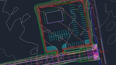
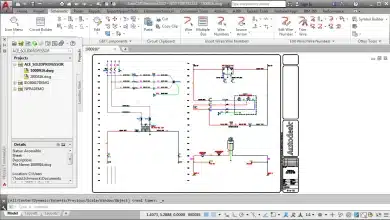
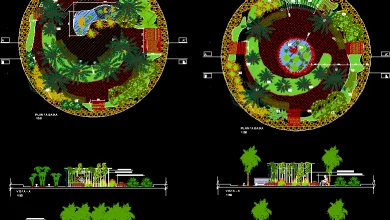
Are you interested in mastering AutoCAD Civil 3D? Whether you’re a beginner or looking to enhance your skills, this comprehensive guide is here to help you unlock the full potential of this powerful software. AutoCAD Civil 3D is specifically designed for civil engineering tasks, offering a wide range of features and functionalities to streamline infrastructure design, analysis, and documentation. In this article, we will explore various aspects of AutoCAD Civil 3D, including its key features, getting started with the software, mastering essential concepts and techniques, and valuable learning resources. By the end, you’ll have the knowledge and resources to embark on your journey to becoming a proficient AutoCAD Civil 3D user.
Key Takeaways
- AutoCAD Civil 3D is a specialized version of AutoCAD tailored for civil engineering tasks, offering advanced functionalities for designing, analyzing, and documenting infrastructure projects.
- Getting started with AutoCAD Civil 3D involves installation, familiarization with the user interface, and accessing learning resources such as official documentation, online tutorials, and courses.
- Mastering AutoCAD Civil 3D requires time, practice, and dedication. Utilize available resources, engage with the community, and continuously challenge yourself with practical exercises.
- AutoCAD Civil 3D encompasses features such as surface modeling, alignment and profile design, corridor and assembly creation, grading and earthwork analysis, pipe network design, and collaboration tools.
- Autodesk offers certification programs for AutoCAD Civil 3D, validating your skills and enhancing your professional credibility in the field of civil engineering.
AutoCAD Civil 3D: An Overview
AutoCAD Civil 3D is a specialized version of AutoCAD, tailored specifically for civil engineering tasks. It combines the familiar drafting and design features of AutoCAD with advanced functionalities for civil infrastructure design. Some of the key features of AutoCAD Civil 3D include:
- Surface modeling: Create accurate 3D surface models from survey data, aerial imagery, or existing CAD files. These models serve as the foundation for various design and analysis tasks.
- Alignment design: Design horizontal and vertical alignments for roads, highways, and other linear infrastructure elements. AutoCAD Civil 3D provides tools for creating, editing, and analyzing alignments.
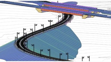
- Profile and corridor design: Generate dynamic profiles and corridors that represent the terrain and design elements along an alignment. This feature allows you to visualize the finished project and perform quantity takeoffs.
- Grading and site design: Design and analyze grading plans for sites, including earthwork calculations, slope analysis, and cut and fill volumes.
- Pipe and pressure network design: Create and analyze underground pipe networks, including stormwater, sanitary sewer, and water distribution systems. AutoCAD Civil 3D provides tools for layout, sizing, and analysis.
- Documentation and collaboration: Generate plan sheets, cross-sections, and other construction documentation directly from the model. AutoCAD Civil 3D also facilitates collaboration by allowing multiple users to work on the same project simultaneously.
Getting Started with AutoCAD Civil 3D
Installation and Setup
To begin your journey with AutoCAD Civil 3D, you need to install the software on your computer. Follow these steps to get started:
- Purchase a license or subscribe to AutoCAD Civil 3D from the official Autodesk website.
- Download the installation package and run the installer.
- Follow the on-screen instructions to complete the installation process.
- Launch AutoCAD Civil 3D and activate your license using the provided serial number or Autodesk account.
User Interface and Navigation
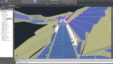
Once you have AutoCAD Civil 3D installed, familiarize yourself with the user interface and navigation tools. The software interface consists of various menus, toolbars, and palettes that enable you to access different commands and functionalities. Spend some time exploring these elements to understand their purpose and organization.
Some essential navigation tools to help you get around the drawing area include:
- Zoom: Use the zoom tools to magnify or reduce the view of your drawing.
- Pan: Pan across the drawing area to navigate to different parts of your design.
- Orbit: Rotate the view in 3D space to examine your model from different angles.
- Viewports: Split the drawing area into multiple viewports to view different parts of your design simultaneously.
Learning Resources
To master AutoCAD Civil 3D, it’s crucial to invest time in learning and practice. Here are some valuable resources to aid your learning journey:
- Official Autodesk Documentation: Visit the Autodesk website and access the official documentation for AutoCAD Civil 3D. The documentation provides detailed explanations of various features, along with step-by-step tutorials and examples.
- Online Tutorials and Courses: Explore online platforms such as Udemy, Coursera, and LinkedIn Learning for AutoCAD Civil 3D tutorials and courses. These platforms offer a wide range of video-based courses, allowing you to learn at your own pace.
- Forums and Communities: Join online forums and communities dedicated to AutoCAD Civil 3D. Engage with other users, ask questions, and share your experiences. The Autodesk forums and Reddit’s r/civil3d are great places to start.
- YouTube Channels: Subscribe to YouTube channels that provide tutorials and tips for AutoCAD Civil 3D. Channels like “CAD Intentions” and “Civil 3D Plus” offer valuable insights and instructional videos.
- Practice Exercises: Practice is key to mastering any software. Look for practice exercises and sample projects that allow you to apply your knowledge and enhance your skills. Autodesk’s official website and online platforms like GrabCAD often provide downloadable exercise files.
Mastering AutoCAD Civil 3D: Key Concepts and Techniques
1. Understanding Surfaces
Surfaces are fundamental in AutoCAD Civil 3D. They represent the existing or proposed terrain and serve as the basis for design and analysis. Here are some essential concepts related to surfaces:
- Creating a Surface: Import survey data or generate a surface from point cloud data to create a 3D representation of the terrain.
- Surface Editing: Use tools like breaklines, boundaries, and surface manipulations to refine your surface model and ensure accuracy.
- Surface Analysis: Perform analysis tasks such as slope analysis, volume calculations, and cut and fill calculations using surface data.
2. Alignments and Profiles
Alignments and profiles are crucial for designing linear elements like roads and highways. Here’s what you need to know:
- Creating Alignments: Use alignment tools to define horizontal and vertical alignments that represent the centerline of your road design.
- Designing Profiles: Create profiles along the alignment to visualize the road’s vertical characteristics, including grades, superelevation, and vertical curves.
- Profile Editing: Modify profiles to meet design requirements, such as adjusting vertical curves or changing cross slopes.
3. Corridors and Assemblies
Corridors and assemblies enable you to create dynamic 3D models of roadways and other linear infrastructure. Consider the following aspects:
- Building Corridors: Define a corridor by specifying the assembly, alignment, and profile. The software automatically generates the road surface and related features.
- Assemblies: Assemblies are collections of subassemblies that define the shape and structure of road elements like lanes, curbs, and sidewalks. Customize assemblies to match your design requirements.
- Target Mapping: Use target mapping to control how design elements interact with the corridor. This allows you to achieve complex road geometries and cross-sectional variations.
4. Grading and Earthwork
Grading is essential for site development projects. AutoCAD Civil 3D provides tools to design and analyze grading plans. Consider the following aspects:
- Feature Lines: Use feature lines to define the grading boundaries, including slopes, berms, and terraces.
- Surface Grading: Apply grading tools to create smooth and efficient surface models, taking into account cut and fill volumes.
- Volume Calculations: AutoCAD Civil 3D can automatically calculate earthwork volumes, allowing you to estimate material quantities and costs accurately.
5. Pipe Networks
AutoCAD Civil 3D facilitates the design and analysis of pipe networks. Here’s what you should know:
- Creating Pipe Networks: Use pipe network tools to define the layout of underground pipe systems, such as stormwater, sanitary sewer, or water distribution networks.
- Sizing and Analysis: AutoCAD Civil 3D provides hydraulic analysis tools to size pipes, calculate flow rates, and evaluate network performance.
- Labeling and Annotation: Add labels and annotations to pipe networks to enhance clarity and documentation.
FAQ: How to Master AutoCAD Civil 3D for Beginners
1. Can you design a house in Civil 3D?
While AutoCAD Civil 3D is primarily designed for civil engineering and infrastructure projects, such as roads, highways, and land development, it is not the most suitable software for designing houses. AutoCAD Architecture or Autodesk Revit are better options for residential building design. These software programs offer specialized tools and features specifically tailored for architectural design, including floor plans, walls, windows, doors, and other components necessary for house design. They also provide capabilities for generating construction documentation and collaborating with other professionals involved in the building design process.
2. Do I need AutoCAD if I have Civil 3D?
No, you do not need to have AutoCAD separately if you have AutoCAD Civil 3D. AutoCAD Civil 3D is built on the AutoCAD platform and includes all the functionality of AutoCAD. It integrates additional specialized tools and features specifically designed for civil engineering and infrastructure projects. With AutoCAD Civil 3D, you can perform all the tasks that AutoCAD can handle, such as drafting, editing, and annotating drawings. Additionally, AutoCAD Civil 3D offers advanced capabilities for working with terrain, alignments, profiles, surfaces, pipe networks, and more. Therefore, if your primary focus is civil engineering design, AutoCAD Civil 3D provides a comprehensive solution without the need for a separate AutoCAD license.
3. Do structural engineers use Civil 3D?
While Civil 3D is primarily used in the field of civil engineering for infrastructure design, structural engineers typically use other software programs more suitable for their specific requirements. Structural engineers often rely on dedicated structural analysis and design software, such as Autodesk Revit, Tekla Structures, or SAP2000. These software programs offer specialized tools and capabilities for modeling, analyzing, and designing various types of structures, including buildings, bridges, and other architectural elements. However, Civil 3D can be used collaboratively with these structural design software programs to ensure coordination between civil and structural components of a project.
4. How do I start Civil 3D?
To start using AutoCAD Civil 3D effectively, it is recommended to follow these steps:
- Installation and Setup: Install AutoCAD Civil 3D on your computer following the instructions provided by Autodesk. Ensure that your computer meets the system requirements for running the software smoothly.
- Familiarize Yourself with the User Interface: Launch AutoCAD Civil 3D and explore the user interface. Familiarize yourself with the menus, toolbars, and palettes. Learn how to access various commands and functionalities.
- Access Learning Resources: Take advantage of the available learning resources, such as Autodesk’s official documentation, online tutorials, and courses. These resources provide step-by-step instructions, video demonstrations, and practical exercises to help you grasp the fundamental concepts and workflows of AutoCAD Civil 3D.
- Practice Exercises: Practice is crucial for gaining proficiency in AutoCAD Civil 3D. Look for practice exercises and sample projects to apply what you’ve learned. Autodesk’s official website and online communities often provide downloadable exercise files that you can use to practice different tasks and workflows.
- Engage with the Community: Join online forums, communities, and social media groups dedicated to AutoCAD Civil 3D. Engaging with fellow users can help you gain insights, ask questions, and share your experiences. It is also an excellent way to stay updated with the latest tips, tricks, and industry trends.
By following these steps and dedicating time to learning and practicing, you can start using AutoCAD Civil 3D effectively and efficiently.
5. How long does it take to master Civil 3D?
The time it takes to master AutoCAD Civil 3D depends on various factors, including your previous experience with similar software, your dedication to learning, and the complexity of the projects you aim to work on. While it is challenging to provide an exact timeframe, it typically takes several months of consistent practice and learning to become proficient in AutoCAD Civil 3D.
To expedite the learning process, it is essential to leverage available learning resources, such as official documentation, online tutorials, and courses. Engaging in practical exercises and working on real-world projects can also accelerate your learning. Regular practice, coupled with hands-on experience, will help you gain confidence and efficiency in using AutoCAD Civil 3D. It is worth noting that mastering any software is an ongoing process, as updates and new features are regularly introduced. Continuous learning and staying updated with the latest industry trends will contribute to your long-term mastery of AutoCAD Civil 3D.
6. How much is AutoCAD Civil 3D training?
The cost of AutoCAD Civil 3D training can vary depending on the training provider, the format of the training (in-person or online), and the level of expertise covered (beginner, intermediate, or advanced). Some training options may include bundled courses or subscriptions that provide access to a range of training materials.
For example, Autodesk offers official training courses for AutoCAD Civil 3D through their Autodesk Authorized Training Centers (ATC). The cost of these courses can vary depending on the location and the specific training package you choose. Online platforms such as Udemy and LinkedIn Learning also offer AutoCAD Civil 3D courses at varying prices, depending on the instructor and the depth of the course content.
It is recommended to research different training options, compare prices, read reviews, and consider the quality and comprehensiveness of the training materials before making a decision. Additionally, some training providers offer free introductory courses or trial periods that allow you to explore the training content before committing to a paid program.
7. Is Civil 3D a BIM tool?
Yes, AutoCAD Civil 3D can be considered a Building Information Modeling (BIM) tool. BIM is a process that involves creating and managing digital representations of the physical and functional characteristics of a project. It goes beyond 3D modeling by incorporating additional information such as geometry, spatial relationships, and data attributes. AutoCAD Civil 3D integrates BIM capabilities by allowing you to create intelligent, data-rich models of civil infrastructure projects.
In AutoCAD Civil 3D, you can create and manage objects such as alignments, profiles, surfaces, and pipe networks, which are interconnected and parametrically associated. These objects contain valuable information about the design, including dimensions, materials, and other properties. By leveraging this information, AutoCAD Civil 3D enables you to generate accurate quantity takeoffs, perform clash detection, and streamline the production of construction documentation. The software also supports industry-standard exchange formats, such as Industry Foundation Classes (IFC), which facilitate collaboration with other BIM software platforms.
Therefore, AutoCAD Civil 3D plays a significant role in the BIM process for civil engineering projects, promoting improved coordination, increased efficiency, and enhanced project outcomes.
Conclusion
Mastering AutoCAD Civil 3D is a rewarding journey that empowers you to efficiently design, analyze, and document civil engineering projects. By understanding the key concepts and techniques covered in this guide, and by utilizing the available learning resources, you can embark on a path to becoming a proficient user of AutoCAD Civil 3D. Remember that practice and hands-on experience are crucial for developing your skills and confidence with the software. Stay engaged with the AutoCAD Civil 3D community, explore real-world projects, and continually update your knowledge as the software evolves. With dedication and perseverance, you’ll be equipped to tackle complex civil engineering tasks and contribute to the success of infrastructure projects. So, let’s get started and unleash the power of AutoCAD Civil 3D!

