In the rapidly evolving field of civil engineering, choosing the right Computer-Aided Design (CAD) software can be a decisive factor in project success. This article delves into the seven best CAD software for civil engineers. We explore their unique features, pros and cons, Faqs and usability to help you find the perfect tool for your engineering needs.
Key Takeaways
- AutoCAD Civil 3D and Civil 3D are potent tools for complex civil infrastructure projects with their dynamic 3D modeling capabilities and extensive design features.
- Bentley MicroStation excels in infrastructure projects with its advanced 3D capabilities, while SketchUp is noted for its user-friendly interface and versatility.
- BricsCAD offers an affordable alternative to AutoCAD, featuring robust 2D drafting and 3D modeling tools, whereas Civil Designer shines in infrastructure design.
- Carlson Civil offers a comprehensive suite of civil engineering design tools with an emphasis on land development and road design.
Best CAD Software for Civil Engineers
Selecting the best CAD software involves considering various factors such as features, ease of use, compatibility, and cost. Let’s dive in to explore the top picks in 2023.
1. AutoCAD Civil 3D
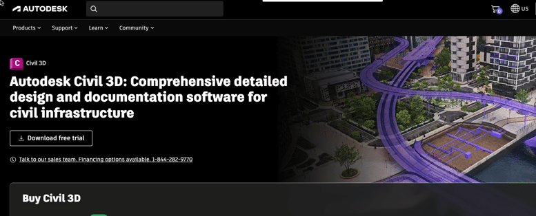
AutoCAD Civil 3D is a product of Autodesk, an industry-leading company in the field of CAD software. It has firmly established its reputation as a staple software in the world of civil engineering.
- Features: 3D modeling, surveying tools, geospatial analysis, storm and sanitary analysis, etc.
- Ease of Use: Intermediate to advanced users
- Compatibility: Windows
- Cost: Subscription-based
AutoCAD Civil 3D offers an array of tools tailored to accommodate the needs of civil engineers. The software supports both 2D drafting and 3D modeling, allowing professionals to visualize, simulate, and analyze real-world performance of their designs.
One of the notable strengths of AutoCAD Civil 3D is its dynamic modeling. Changes made in one part of the design are automatically updated throughout the model. This feature enhances productivity, as it eliminates the need for manual updates and prevents potential inconsistencies in design.
Here’s a breakdown of some of the standout features of AutoCAD Civil 3D:
- 3D modeling: The software supports solid, surface, and mesh models, providing engineers with a versatile toolkit to realize their designs.
- Surveying tools: AutoCAD Civil 3D offers surveying tools for collecting and analyzing topographical data. These tools help engineers plan, conduct, and manage surveys efficiently.
- Geospatial analysis: With AutoCAD Civil 3D, engineers can incorporate geographic and demographic information into their designs. This feature facilitates more informed decision-making in site selection and planning.
- Storm and sanitary analysis: This feature allows engineers to perform hydrologic and hydraulic analysis for stormwater and wastewater systems. It aids in the design of stormwater and sewer systems, ensuring they meet regulatory standards and function efficiently.
While AutoCAD Civil 3D is extremely powerful, it’s best suited for intermediate to advanced users due to its complex features and functionalities. That being said, Autodesk does provide extensive learning resources, including tutorials and community forums, to help users get up to speed.
AutoCAD Civil 3D is compatible with the Windows operating system, but users can utilize the cloud-based version to work on other operating systems. The software operates on a subscription-based model, which includes the software license, access to the latest updates and releases, and technical support from Autodesk.
2. Bentley MicroStation

Bentley MicroStation is a highly-regarded CAD software offering cutting-edge 3D capabilities and an exhaustive suite of drawing tools. It stands out particularly in infrastructure projects, including transportation, utilities, buildings, and more.
Bentley MicroStation provides robust functionalities in both 2D drafting and 3D modeling, allowing civil engineers to create complex, detailed, and precise designs. Moreover, the platform is revered for its parametric modeling capabilities, empowering users to automate repetitive drafting tasks and maintain design intent throughout the project.
- Features: 2D/3D drafting, parametric modeling, geospatial applications, etc.
- Ease of Use: Intermediate to advanced users
- Compatibility: Windows
- Cost: Subscription-based
Here are some of the standout features:
- 2D/3D Drafting: MicroStation supports both 2D drafting and 3D modeling, enabling engineers to communicate their designs effectively and accurately.
- Parametric Modeling: With this feature, engineers can create intelligent 3D models using constraints and relationships. This allows for rapid iterations and modifications of designs, facilitating a faster design process.
- Geospatial Applications: MicroStation provides tools for engineers to incorporate geospatial data into their designs, offering a deeper understanding of geographic and environmental factors that might impact a project.
MicroStation’s powerful capabilities make it suitable for intermediate to advanced users. Beginners may face a steep learning curve, but Bentley offers comprehensive learning resources, including online courses, tutorials, and a dedicated user community, to ease this process.
While the software is primarily compatible with Windows, Bentley also offers cloud-based solutions that allow users to access their projects from any device.
Bentley MicroStation operates on a subscription-based model. The subscription includes the software license, regular updates and upgrades, and customer support services.
3. SketchUp

SketchUp is a highly popular CAD software recognized for its user-friendly interface and versatile capabilities. It’s suitable for both simple sketches and complex 3D designs, making it a widely preferred tool across different levels of expertise.
One of the key appeals of SketchUp is its intuitive “push-and-pull” design approach, which simplifies the process of 3D modeling. This makes it particularly accessible for beginners while still offering advanced capabilities for professional applications.
- Features: 2D drawing, 3D modeling, lighting effects, texturing, etc.
- Ease of Use: Beginner to advanced users
- Compatibility: Windows, macOS
- Cost: Free version, Pro version is subscription-based
Let’s explore some of its main features:
- 2D Drawing: SketchUp offers a comprehensive suite of 2D drawing tools, allowing users to create detailed plans, elevations, and sections.
- 3D Modeling: Beyond 2D drawing, SketchUp excels in creating 3D models. The user-friendly approach and versatile tools make it a suitable choice for both basic and complex designs.
- Lighting Effects: SketchUp allows you to simulate real-world lighting conditions in your models, improving the visualization and realism of your designs.
- Texturing: Users can apply various textures to their designs, improving the realism and enhancing the visual appeal of the models.
SketchUp’s ease of use extends from beginners to advanced users, largely thanks to its intuitive interface. While mastering all of its functionalities might take some time, beginners can quickly grasp the basics and start creating designs.
Compatibility-wise, SketchUp runs on both Windows and macOS, giving users flexibility across different platforms. Moreover, SketchUp offers both a free version, SketchUp Free, which is a web-based application, and a professional version, SketchUp Pro. The Pro version is subscription-based and comes with additional features, such as advanced drawing tools, the ability to import and export various file formats, and comprehensive technical support.
4. BricsCAD
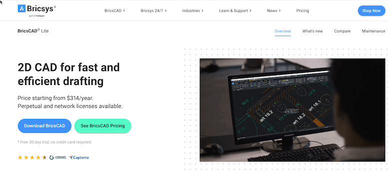
BricsCAD offers a powerful suite of features similar to AutoCAD, but at a more budget-friendly price point. It’s a comprehensive tool for both 2D drafting and 3D modeling, with added functionality for BIM and mechanical design.
BricsCAD’s flexible platform covers all the phases of design, from drafting to modeling to detailing and documentation, making it a one-stop solution for various design needs. The software supports a wide range of applications, including architectural design, mechanical design, civil engineering, and more.
- Features: Direct modeling, 3D compare, BIM, machine learning tools, etc.
- Ease of Use: Intermediate users
- Compatibility: Windows, macOS, Linux
- Cost: Subscription-based
Here’s an overview of its key features:
- Direct Modeling: BricsCAD’s direct modeling feature allows users to modify geometry without the constraints of a history tree, offering more flexibility in the design process.
- 3D Compare: This tool helps engineers identify the differences between 3D models by color-coding the changes. This can be incredibly beneficial during the design review and revision process.
- BIM: BricsCAD BIM takes the software to another level by supporting Building Information Modeling. This aids in streamlining workflows and improving collaboration across different stages of the design and construction process.
- Machine Learning Tools: BricsCAD leverages machine learning to optimize workflows. The AI tools can predict user’s commands, making the design process more efficient.
While BricsCAD offers advanced features, it is best suited for intermediate users due to its complexity. However, Bricsys provides a variety of learning resources to help users navigate the software.
The software is compatible with multiple operating systems, including Windows, macOS, and Linux. This wide range of compatibility ensures users can access their designs on various platforms.
BricsCAD operates on a subscription-based model, offering both annual and monthly plans. Users also have the choice between BricsCAD Lite, Pro, BIM, and Mechanical, each with different features and price points.
5. Civil Designer
Civil Designer is a dedicated CAD software tailored for infrastructure design. It offers an all-in-one solution for various design elements such as roads, water, sewer, and stormwater, making it a specialized tool for civil engineers.
Designed to streamline complex design workflows, Civil Designer provides robust, industry-specific functionalities. Its integrated design modules enable efficient sharing of data across different project aspects, enhancing productivity and design consistency.
- Features: Terrain modeling, road design, water reticulation, sewer and stormwater network design, etc.
- Ease of Use: Intermediate to advanced users
- Compatibility: Windows
- Cost: Purchase or rental options available
Let’s delve into its standout features:
- Terrain Modeling: Civil Designer offers powerful tools for creating detailed, accurate terrain models. This assists engineers in understanding the topographical context of their projects, informing better design decisions.
- Road Design: The software includes a comprehensive set of tools for road design, allowing for the creation of detailed, accurate designs. This includes functions for horizontal and vertical alignments, cross-sections, and more.
- Water Reticulation: Civil Designer allows engineers to design and analyze water distribution systems. The software supports pressure and flow analysis, helping engineers ensure the efficiency and reliability of the systems.
- Sewer and Stormwater Network Design: The software provides tools to design and analyze sewer and stormwater networks, supporting both gravitational and pressurized systems. This includes features for hydraulic and hydrological analysis.
Given the comprehensive functionalities and industry-specific nature of Civil Designer, it is best suited for intermediate to advanced users. While the software may seem complex to newcomers, extensive learning resources and support are provided to help users get the most out of the software.
Civil Designer is compatible with Windows and provides both purchase and rental options, offering flexibility to suit different budget constraints and project needs. This means that users can opt for a permanent license or choose a time-limited rental based on their needs.
6. Carlson Civil

Carlson Civil is a comprehensive CAD software that provides a full suite of civil engineering design tools. It particularly excels in areas of land surveying and road design, making it a powerful tool for civil engineers working in various sectors, from land development to transportation.
Carlson Civil’s comprehensive suite of tools covers a wide range of needs in civil engineering. Whether it’s lot design, site grading, road network design, or hydrological analysis, the software is equipped to handle it.
- Features: Lot design, site grading, road network design, hydrology, etc.
- Ease of Use: Intermediate to advanced users
- Compatibility: Windows
- Cost: Perpetual license
Let’s delve into some of its key features:
- Lot Design: Carlson Civil provides tools to automate the process of lot design, including boundaries, dimensions, and area calculations. This can significantly speed up the design process for land development projects.
- Site Grading: The software includes robust grading tools to help engineers design, visualize, and analyze site grading plans. These tools support both manual and automatic grading, providing flexibility in approach.
- Road Network Design: The software’s road network design capabilities allow engineers to design intricate road networks with accuracy and efficiency. This includes tools for both horizontal and vertical alignment, intersections, roundabouts, and more.
- Hydrology: Carlson Civil’s hydrology tools help engineers to analyze and design stormwater management systems. This includes functions for rainfall analysis, runoff calculation, and detention pond design.
Considering the comprehensive and complex nature of Carlson Civil’s functionalities, it’s best suited for intermediate to advanced users. However, Carlson provides an array of learning resources and customer support to help users navigate the software.
The software is compatible with Windows and comes with a perpetual license. This means that users only need to purchase the software once and can use it indefinitely, offering cost savings in the long run.
7. ArcGIS
ArcGIS is a powerful geographic information system (GIS) software developed by Esri. It’s known for its sophisticated geospatial analysis capabilities and comprehensive mapping features. ArcGIS excels in creating and using maps, compiling geographic data, analyzing mapped information, and managing geographic information in a database.
- Features: Geospatial analysis, map creation, data visualization, location tracking, etc.
- Ease of Use: Intermediate to advanced users
- Compatibility: Windows, iOS, Android (ArcGIS Online)
- Cost: Subscription-based
Let’s delve into some of its key features:
1. Geospatial Analysis: ArcGIS offers a wide array of spatial analysis tools that allow users to examine relationships, test predictions, and ultimately make better decisions. It includes capabilities for overlay analysis, proximity analysis, statistical analysis, and pattern analysis. It also allows users to create custom analysis tools.
2. Map Creation: With ArcGIS, users can create beautiful, interactive maps. The software allows for customization in symbology, annotation, and layout. You can easily add data layers, adjust map scales, and even publish your maps for online usage.
3. Data Visualization: ArcGIS allows you to turn your data into visual stories. It offers an array of visualization methods such as charts, graphs, and thematic maps, and 3D visualization capabilities for a more immersive perspective.
4. Location Tracking: Location tracking in ArcGIS provides the ability to record where people or assets are and where they have been. This is particularly useful for logistical and management tasks.
5. Data Management: ArcGIS offers comprehensive data management capabilities. It provides a centralized framework to manage, share, and control access to your geospatial data.
6. Integration and Interoperability: ArcGIS is known for its compatibility with numerous data formats and systems. It can integrate with other systems and databases, as well as cloud platforms, to allow for seamless data sharing and collaboration.
7. GIS in the Field: ArcGIS provides field mapping solutions that allow users to collect and record data in the field using mobile devices. This can streamline data collection and update processes, increase accuracy, and improve the timeliness of data capture.
These features together make ArcGIS a highly robust and versatile tool for any organization that requires sophisticated geospatial analysis and data management.
Comparison of these CAD software for civil engineers:
here’s a comparative table for the mentioned software:
| Software | Pros | Cons | Price | Compatibility | Ranking |
|---|---|---|---|---|---|
| AutoCAD Civil 3D | Comprehensive design features, great for civil engineering, dynamic 3D modeling | Can be complex to use, expensive | Subscription-based | Windows | 1 |
| Bentley MicroStation | Advanced 3D capabilities, extensive drawing tools | High learning curve, expensive | Subscription-based | Windows | 2 |
| SketchUp | User-friendly, versatile, large collection of user-generated models | Limited features in free version | Free version available, Pro version is subscription-based | Windows, macOS | 3 |
| BricsCAD | Affordable, robust 2D drafting and 3D modeling | Limited advanced features compared to AutoCAD | Subscription-based | Windows, macOS, Linux | 4 |
| Civil Designer | Designed for infrastructure design, comprehensive solutions for roads, water, sewer, and stormwater design | Requires technical knowledge, not suitable for architectural design | Purchase or rental options available | Windows | 5 |
| Carlson Civil | Comprehensive suite of civil engineering design tools, good for land development and road design | Interface may feel outdated, lacks robust 3D modeling tools | Perpetual license | Windows | 6 |
| ArcGIS | Sophisticated geospatial analysis, comprehensive mapping features | Requires technical knowledge, can be expensive | Subscription-based | Windows, iOS, Android (ArcGIS Online) | 7 |
Please note that the ranking is subjective and will depend on the specific needs and preferences of the user. For example, if the user is more interested in geospatial analysis, ArcGIS might be the top choice, while for more general civil engineering design, AutoCAD Civil 3D might be preferred.
Factors to Consider when Choosing CAD Software
To select the best CAD software for your civil engineering projects, consider the following:
- Functionality: The software should have the necessary tools to complete your projects. Consider if it supports 2D and 3D design, BIM, etc.
- Ease of use: User-friendly software can enhance your workflow, saving time and effort.
- Price: Some CAD software may be free, while others can be quite costly. Identify your budget and find a software that fits within it.
- Training and Support: Look for software that provides training and customer support.
- Hardware requirements: Ensure your computer meets the software’s system requirements.
- Integration: The software should integrate with other tools you use in your workflow.
Finally, don’t forget to take advantage of free trials. They can be incredibly helpful in determining if a specific CAD software suits your needs before making a financial commitment. Choose wisely, and let technology aid you in bringing your civil engineering designs to life.
FAQs
1. What are the main advantages of using AutoCAD Civil 3D?
AutoCAD Civil 3D supports BIM (Building Information Modeling) with integrated features for drafting, design, and construction documentation. It’s great for civil infrastructure projects due to its powerful 3D modeling capabilities and automated design adjustments.
2. Are there any downsides to Bentley MicroStation?
While Bentley MicroStation is a powerful tool with advanced 3D capabilities, it has a complex interface that can be challenging for beginners. Additionally, it is higher in price compared to some other software options.
3. Is SketchUp good for complex civil engineering designs?
Yes, SketchUp can handle complex designs. However, for very intricate designs with advanced engineering requirements, other software like AutoCAD Civil 3D or Civil 3D might be more suitable due to their specialized civil engineering tools.
4. How does BricsCAD compare to AutoCAD?
BricsCAD offers many features similar to AutoCAD, making it a robust tool for 2D drafting and 3D modeling. It also includes additional functionalities like machine learning tools. However, it may be complex for beginners.
5. Why choose Civil Designer for infrastructure design?
Civil Designer is specifically designed for infrastructure design. It offers comprehensive solutions for roads, water, sewer, and stormwater design, making it an ideal tool for projects in these areas.
6. What are the limitations of Carlson Civil?
While Carlson Civil is a comprehensive civil engineering design software, its complexity can pose difficulties for beginners. Some users also report that the interface feels slightly outdated.
7. Is Civil 3D suitable for beginners?
Civil 3D is a complex software with advanced functionalities, which might present a steep learning curve for beginners. However, Autodesk offers comprehensive learning resources to help users get familiar with the software.
8. Does SketchUp offer a free version?
Yes, SketchUp offers a free version which is suitable for simple 3D modeling tasks. For access to more advanced features, users can upgrade to SketchUp Pro, which is a paid version.
9. How user-friendly is BricsCAD for new users?
BricsCAD has a relatively user-friendly interface but may still be complex for beginners due to the breadth of its functionalities. Bricsys offers extensive learning resources to help users navigate the software.
10. Can Civil Designer be used on macOS?
No, Civil Designer is currently compatible only with Windows.
11. What sets Carlson Civil apart from other CAD software?
Carlson Civil excels in land development and road design, with a full suite of civil engineering tools. Unlike some other software, it comes with a perpetual license, which means you only need to purchase the software once.
12. How does Civil 3D support collaborative work?
Civil 3D supports cloud-based collaboration, allowing team members to collaborate on shared design data in real-time. This functionality enhances communication and project efficiency.
13. Does AutoCAD Civil 3D provide support for geospatial analysis?
Yes, AutoCAD Civil 3D includes geospatial analysis tools that help in the examination of geographic and spatial relationships in your data.
14. Can Bentley MicroStation handle parametric modeling?
Yes, Bentley MicroStation supports parametric modeling, allowing designers to use relationships between elements to build complex designs.
15. Does BricsCAD offer a free trial?
Yes, BricsCAD offers a free trial. It provides a good opportunity to test out the features and see if the software meets your needs before purchasing a subscription.
16. Can Civil 3D be used for residential projects?
Yes, Civil 3D is a versatile software suitable for a wide range of projects, including residential ones. Its robust tools for plan production, profiles, and corridor modeling can be very useful in residential project design.
Conclusion
The choice of CAD software for Civil Engineers should align with the needs of the project, the expertise of the team, and budgetary considerations. Each of the software discussed offers unique benefits and potential drawbacks. By understanding the strengths and weaknesses of each, you can make an informed decision that best suits your professional needs, optimizes your design process, and ensures successful project outcomes.